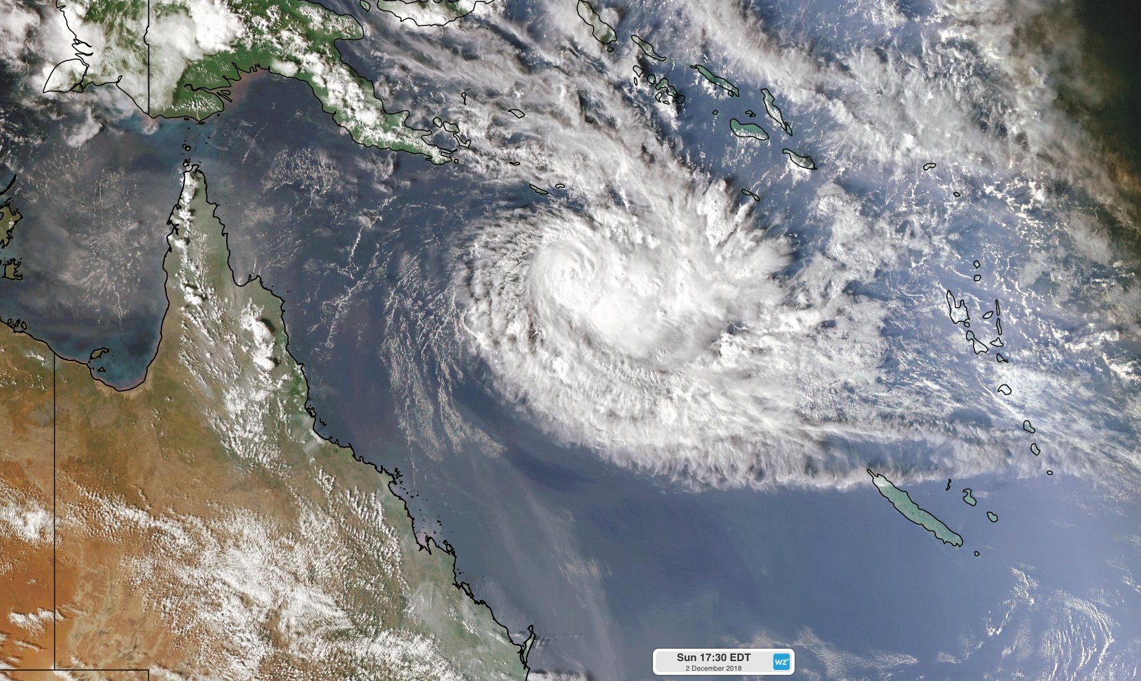
Australia's first tropical cyclone of the 2018/19 season developed over the northern Coral Sea on Sunday, and it should help cause some rain over fire-ravaged central Queensland during the middle of this week.
Since forming on Sunday afternoon, Tropical Cyclone Owen has been lingering about 1000 km off the coast of northern Queensland. Owen was a category one tropical cyclone on Monday morning and may intensify into a category two system later in the day. Fortunately, it's too far away from Australia to pose a direct threat to Australia's coastline in the near-future.
We hope this Cyclone will help put out the fires in QLD.
K.J.
__________________
From Coast to Coast, We'll see it all.......One Day
I think weather technology has improved over the years since TC Tracey but cyclones can be quite unpredictable (some say they are like women). The last half dozen to visit Qld have generally followed the "cyclone map" predictions. Some eg TC Charley (in the late 80s), wandered all over the place, disappearing, then "Look, it's coming back" as it came in at Alva Beach & showing the housing modifications required in Ayr!
All down the east coast to Gladstone desperately needs rain - especially where the fires are! There is a thunderstorm going on at the moment in Townsville - minimal rain has come out of it so far. We're hoping that lightning doesn't start any more fires.
During our now over 30 years in Townsville, it is only since Monica (2006) that every cyclone to visit has been a cat 4 or a 5 (Larry, Yasi, Debbi). Category 1, 2 cyclones are "bearable" in our cyclone strengthened houses - it's the nasty cat 3-5 ones that do the maximum of damage.
TC Owen is being shown to give Cardwell to Ingham about 130mm of rain, Townsville - 50mm.
__________________
Warren
----------------
If you don't get it done today, there's always tomorrow!